Guatemala and its People
|
No, this web page isn't really about Guatemala and its people. Instead it's a peek at one off the beaten track and unglamorous area around Lake Peten Itza in Northern Guatemala, whose only claim to fame is that it's near the extraordinary Maya city of Tikal. |
|
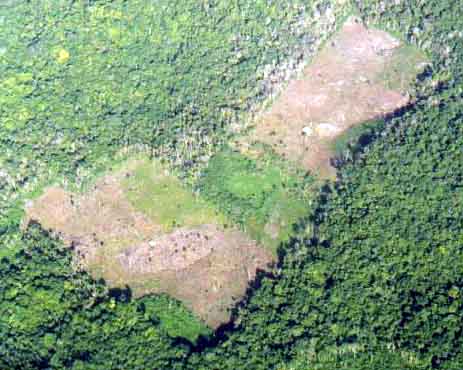
The area around Lake Peten Itza is economically backward and undeveloped compared to the rest of Guatemala, mostly because of its isolation from the main transport routes. Even now, most people fly in to the area, though it is possible to drive from Mexico, Belize, or the rest of Guatemala. Flying over the jungle one passes over a number of small landholdings where farmers have hacked fields out of the jungle. However, in 1990 the government set aside the Northernmost one million hectares of the country as the Maya Biosphere Reserve, including the area around Tikal, just North-East of the lake. This reserve adjoins similar reserves in Mexico and Belize to create a multinational reserve of over two million hectares. |
 |
|
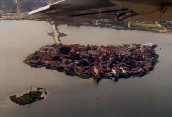
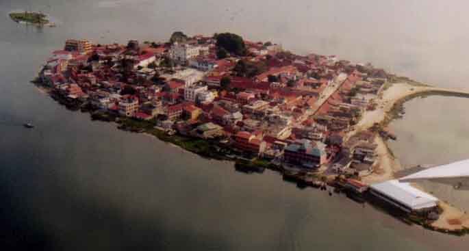
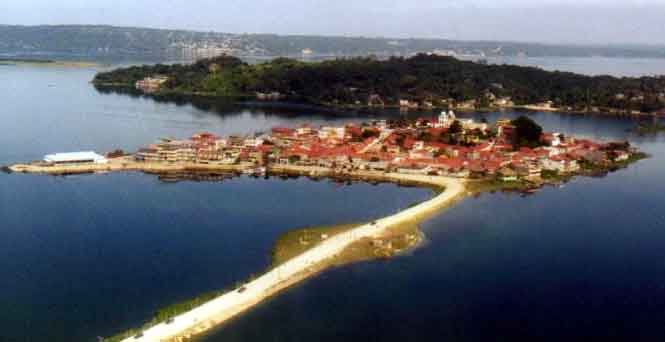
But this is not at all to say that Tikal is the only attraction in the area, although it is easily the main reason that people come. However, the lake and its surrounding towns also have their attractions, and it would be difficult to imagine a more picturesque town than Flores as the plane banks around it to land at the local airport. |
|
 |
|
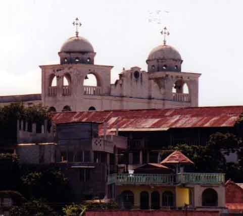
Connected by a short causeway to the lake shore, Flores is dominated by the large white square and church on its low summit. On the mainland are the neighbouring towns of San Benito to the West and Santa Elena to the East, all three commonly referred to as the single town of Flores. Since the government discontinued direct flights into Tikal, Flores has been developed as the tourist center for the area, with the airport, hotels, restaurants and a number of good value internet cafes! |
|
 |
|
|
Flores began its life as a town of the Maya tribe the Itzaes, making Flores the original "Peten Itza" or "island [of the] Itzaes". There are the very unimpressive remains of a Maya site called Tayasal on the neck of land sticking into the lake to the North of Flores, but nothing at all remains of Maya Flores, which was probably the last major functioning Maya center in Central America. It was only around 1700 that the Spanish came in to conquer the island and smashed its pyramids, temples and idols. |
|
|
|
 |
|
|
|
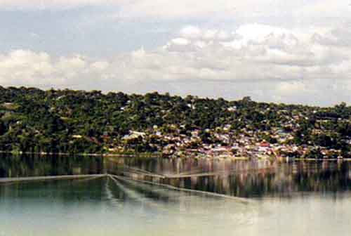
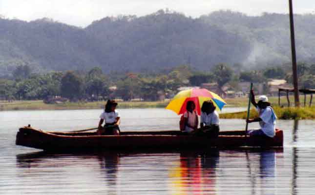
It's possible to take trips on the lake on small motor-driven ferries which wait for passengers at the North-Western end of Flores. Just out of sight to the right of the photo above is a small zoo, with birds, peccaries and local wild cats, including pumas and jaguars. And at the top of the photo, on the far shore of the lake, are the towns of San Andres and San Jose. The ferrymen are friendly, unhurried and eager to make some money, but don't expect much ability with English, it's virtually non-existent (the same is true of some of the restaurants, but the hotels and shops are a little better). But handsigns, a few scattered words of Spanish and some gringo dollars will get you around. |
 |
 |
|
|
San Andres from Tayasal |
 |
|
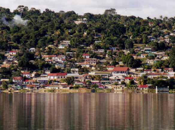
San Andres from the lake |
 |
|
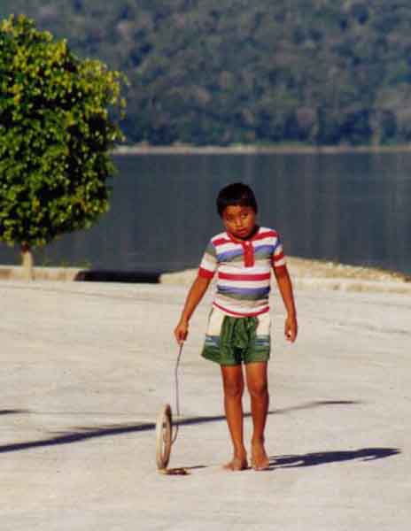
This is no Cancun, and it's not even San Pedro in Belize! Tourists are only a small part of people's existence, dropping like alien beings out of jet aircraft at the airport while the locals go on with their lives. |
 |
 |
 |
 |
|
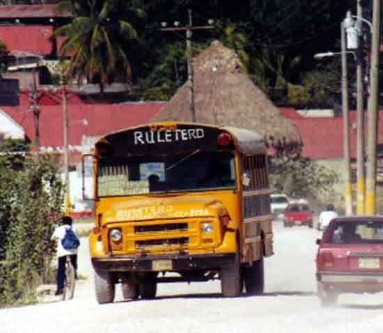
Then it's off to "do" Tikal. Most public buses in Central America are old US school buses, but thankfully the tourist buses and vans are much more modern. Also thankfully, the 70 km road between Flores and Tikal is paved, the only sealed road in the entire province of El Peten, which occupies a third of the entire land area of Guatemala. In fact, the road to Tikal is better than most of the roads in Chicago, where I'm now living. |
 |
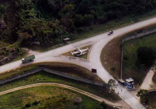 |
The first scenic wonder on the road to Tikal is the army base, just to the East of Santa Elena. Guatemala shares with many of its Central American neighbors a repressive and brutal recent past, especially in the 1970s and 80s, with up to 200,000 of the population (mostly Maya indian) killed by government forces fighting communism. And as usual, the CIA helped out in their own inimitable style (not that the communists were necessarily any better). Predictably, violence became a way of life for some people, even after the end of the fighting, and life became cheaper, which makes me cautious about visiting other parts of Guatemala. To their credit, around 1985 the US government cut off financial support for the military rulers, and in March of 1999 President Clinton toured the area and apologized for wrongs which had been done. |
|
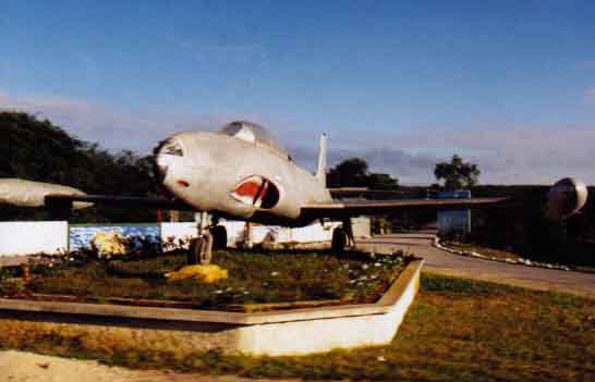
For the benefit of "must know" aircraft enthusiasts, this is a T-33 trainer (the same plane is visible in the photo above) |
 |
|
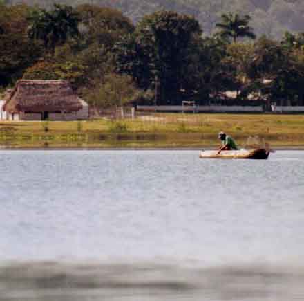
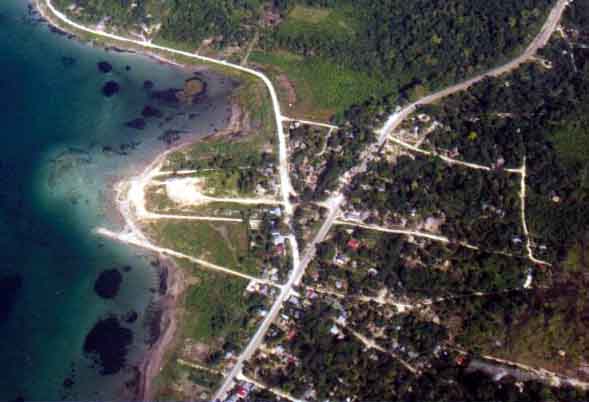
Below is the small town of El Remate, at the extreme North-Eastern end of Lake Peten Itza. El Remate is about half-way between Flores and Tikal, and this has made it popular with some tourists, particularly the backpacker set. At the top right hand corner of the photo, the road continues towards Tikal; heading to the top left is an unpaved road which goes right around the lake, passing an ecological resort and moderately sized nature reserve two or three kilometers outside El Remate. The shallowness and clarity of the water in this picture is typical of the entire lake. |
 |